J. Dennis Baldwin 2021 Field Report
2021 CLAG Field Study Award
The Enigma of S19: A Multidisciplinary Case Study of Novel Water Management Strategies at an Ancient Maya Household
J. Dennis Baldwin, PhD student, The University of Texas at Austin
Abstract
During the summer of 2021, I examined a small residential group and its dam three kilometers north of the Classic Maya center of El Zotz. This project’s objective was to ascertain the chronology of settlement and the creation of landesque capital in the Buenavista Valley of Guatemala. The study combined archaeological excavation of the settlement group with soils studies of the dam’s stratigraphy in order to link them chronologically and to understand the construction methods utilized. Analyses of collected ceramic materials along with radiocarbon dating of charcoal samples from a chultun (a type of ancient subterranean feature) and the dam yielded crucial relative and absolute dates for establishing the site’s chronology. Together these demonstrated that occupation of the site likely began in the 1st century BCE during the Late Preclassic with dam construction following many centuries later in in the early 4th Century CE during the Early Classic period (250-550CE). The majority of the group’s buildings, and all of its most impressive buildings, dated to the Early Classic. The chultun was sealed shortly after the dam was built during the end of the 4th century. However, thick ceramic deposits on top of the chultun and subsequent building in front of it are evidence of continued occupation during the subsequent Late Classic period (550-850CE). This project represents a unique case study of an ancient Maya dam and the small community that built it almost seventeen-hundred year ago. The study also represents the shifting settlement patterns and subsistence strategies taking place in the Buenavista Valley during the Classic period.
Keywords
Maya Archaeology, Water Management, Lidar
Background
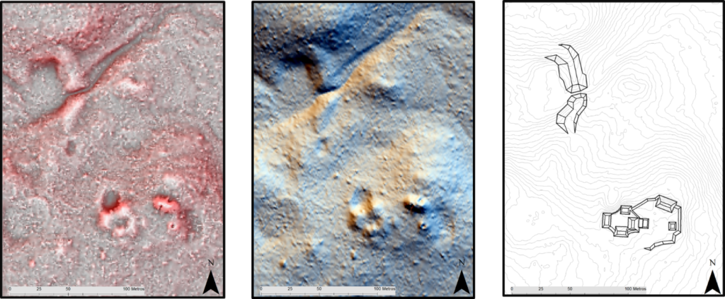
The Biotopo Protegido San Miguel La Palotada El Zotz in northern Guatemala is home to a number of major Maya archaeological sites including the eponymous Classic Maya city of El Zotz. The Proyecto Arqueológico El Zotz (PAEZ) began undertaking archaeological research at the Classic Maya site of El Zotz and its surroundings in 2008. During two lidar data acquisitions in 2016 and 2019, undertaken with support from Fundación Patrimonio Cultural y Natural Maya (PACUNAM), the archaeological project received Lidar data over the entirety of the biotope. These data revealed a stunning ancient landscape that was densely populated and extensively engineered. After preliminary ground-truthing of a pre-selected zone in the lidar dataset in 2019, I became interested in studying a small residential group and its suspected dam.
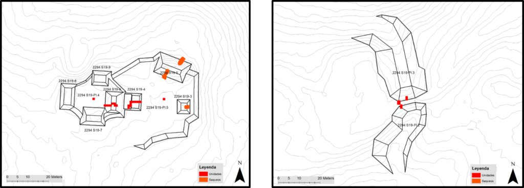
Previously studied Maya dams were located near major sites, but this dam was in a relatively isolated location three kilometers from the nearest major site with only modest settlement group of seven structures 100m to the south located in quadrant 2295.S19 in PAEZ’s grid. However, the scale of “S19” made it an ideal location for a case study of settlement chronology and subsistence strategies in the region that became the foundation for my Master’s thesis.
Fieldwork
Fieldwork consisted of carefully excavating eleven different contexts around the residential group and dam using hand picks and trowels. With the assistance of the archaeological project, I hired six local excavators to help me carry out my ambitious research plan. PAEZ also provided truck transportation to and from the basecamp to our research site at S19. Field research technically began during the summer of 2019 when I surveyed the site and made a surface collection of ceramics from one of the site’s three looter’s trenches.
Looting has been a persistent problem in Maya archaeology and is especially endemic in the Peten department of Guatemala. From large sites to the humblest residential groups, today few mounds have been spared the looter’s pick and S19 is no exception. Despite the damage they cause, however, looter’s trenches do offer one key advantage. For example, while conventional excavations can be time-consuming and onerous, looter’s trenches can serve as ready-made test pits which can still yield valuable archaeological data. For this reason, we cleared out the back dirt and collapse from the residential group’s three looters trenches and documented the exposed architectural profiles. Early Classic ceramics within the disturbed architectural fill dated their construction to that period.
Conventional excavations in the residential group included digging 1 x 1 meter units in the center of each of the two patios, trenching two unlooted structures at the center of the site, and excavating a suspected midden (or trash area) at the center of the site. The excavation units revealed that the patios were both surfaced with a single plaster floor, but preservation of ceramic materials was poor. The trenched structured were located on the eastern and western sides of the western and eastern patios respectively. The larger structure in the western patio was a low structure with 4 broad steps dating to the early classic. The other structure to the east was a small, poorly-preserved platform. Ceramic materials indicate that its construction likely dates to the 5th century CE (close to the end of the Early Classic period). Between the two trenched structures, we discovered a midden with thick deposit of ceramic material dating to the Late Classic on top of a well preserved plaster floor. We excavated four one by one meter units in the midden discovering an unexpected surprise below the last unit.
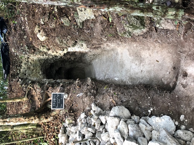
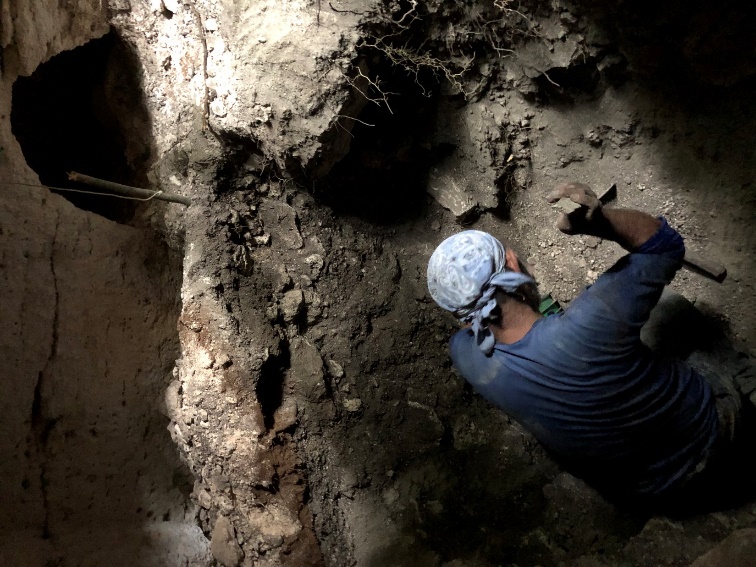
Below the midden, we discovered the aperture of a sealed chultun (a type of subterranean space) which represented the most important context studied during at S19. Within, we discovered stratified deposits of ceramic materials and carbon extending for four-hundred years from the Late Preclassic to the Early Classic. The chultun contained a burial chamber that had evidently been emptied out during ancient times as all of its ceramic materials had been pushed to the margins of the small chamber’s space. A small fragment of an adult long bone was all that remained of the interred individual.
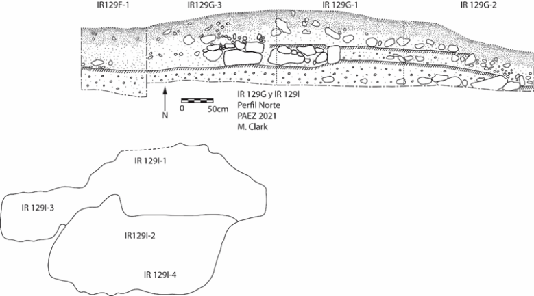
At the dam site, one-hundred meters north of the settlement, we investigated the dam’s stratigraphy by placing an excavation unit just north of the channel bisecting the dam. This excavation revealed 21 distinct soil layers, and subsequent laboratory analyses of collected soil samples revealed (see below) that the dam was built using alternating layers of tamped earth and crushed limestone. Underneath the dam fill layers, a dark soil layer with charcoal and ceramic materials represented sedimentation and deforestation prior to the dam’s construction. Underneath this layer, we discovered natural soil layers on top of the limestone bedrock. The slope of the bedrock indicated that the ancient channel was once north of its current location. Another unit placed at the opening to the channel just upstream revealed a stone footing wall that served as the dam’s foundation and a perpendicular alignment of stones that may have guided flowing water through the dam’s channel. Unfortunately, the onset of the rainy season meant that we could not excavate this unit to its conclusion beyond documenting the extant architecture.
Laboratory Analyses
In total, I analyzed more than 4,500 recovered ceramic materials at the project’s laboratory space in San Lucas Sacatepéquez during the month of July 2021, returning twice in December of 2021 and June of 2022 to finish the analysis. Analysis involved assigning a ceramic ID and vessel type to every sherd that wasn’t too severely eroded. This analysis had to be carried out in Guatemala because export of archaeological materials is highly regulated.
After receiving the appropriate export and import permits from IDAEH (Instituto de Antropología e Historia) and the USDA, respectively, soil samples from the dam were shipped from Guatemala to the Soils and Geoarchaeology Lab at the University of Texas at Austin. Within the laboratory I tested these samples for their magnetic susceptibility and their elemental composition using an XRF. Combined with field observations these analyses helped me characterize the different anthropogenic and natural stratigraphic layers within the dam’s profile. Together, they demonstrated that the Maya constructed their dam with alternating layers of tamped earth and crushed limestone.
Obsidian and carbon samples were sent to external labs to test for their source and dates respectively. The obsidian used to make the blades recovered from the residential group were sourced from the Guatemalan highlands and as far away as central Mexico. Carbon dates from distinct layers in the Chultun demonstrate that the earliest use of the space originates in the last millennium BCE and terminated in the mid fourth century. Carbon recovered from just under the dam construction layers dated to the early 4th century CE. This indicates that just prior to the sealing of the chultun chamber, the residents of S19 built the dam in the arroyo just north of the residential group.
Results & Publication
Ancient landscapes often represent a palimpsest of human activity spanning many different historical periods. Because of this, archaeologists cannot simply rely on proximity to reconstruct historical relationships. Results of my excavations and laboratory analyses conclusively show that occupation of the S19 residential group spanned the centuries prior to and following the dam’s construction. These results demonstrate that in some circumstances ancient Maya communities outside of major site cores were capable of constructing hydrologic infrastructure. These excavations also reveal that the Maya began inhabiting the elevated areas of the Buenavista valley in the Late Preclassic, which later waned during the Late Classic.
Results of these investigations were presented at the Simposio de Investigaciones en Guatemala in 2021 and 2022 in Guatemala City, and at the American Association of Geographers in New York in 2022. A detailed report of the field investigations in Spanish is available here: https://www.mesoweb.com/zotz/El-Zotz-2021.pdf
Acknowledgements
I would like to express my gratitude to CLAG for awarding me their Field Study Award. Their generosity significantly offset equipment costs as well as lodging and transportation expenses while I analyzed materials at the archaeological project’s lab. I would also like to thank the National Endowment for the Humanities for funding my airfare, as well as the National Science Foundation, PACUNAM and the Department of Geography and the Environment at the University of Texas for providing the funding necessary to hire the team of excavators that assisted me during the season.
Pictures of my Research
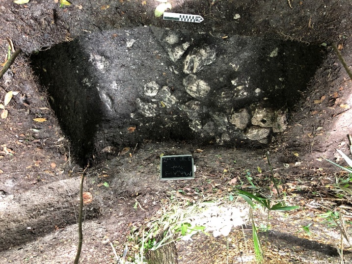
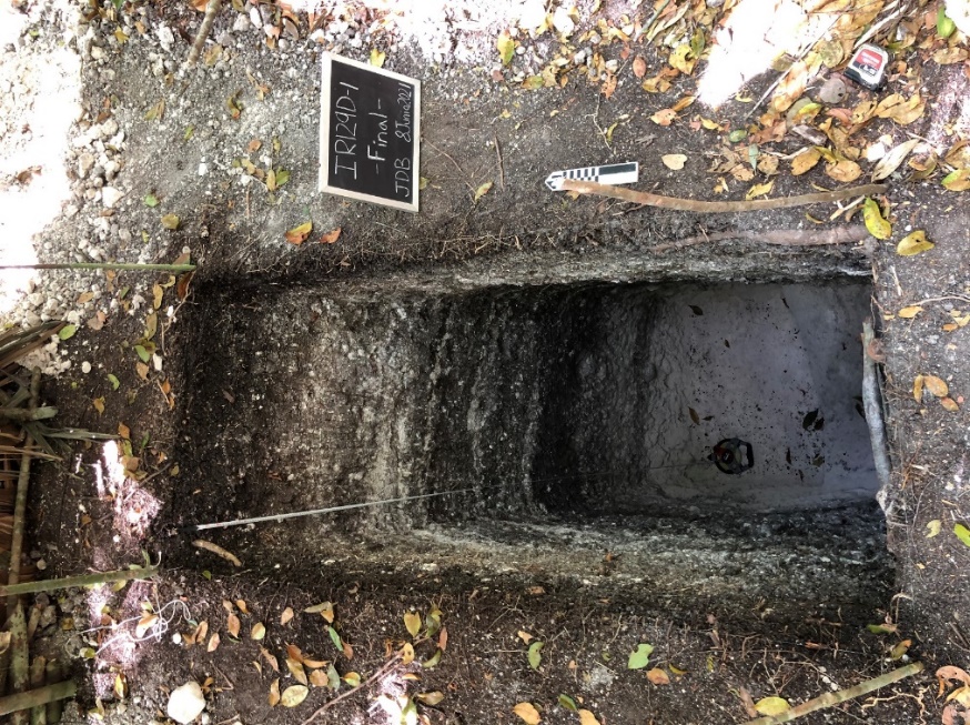
Photos of the dam excavations. The photo at left shows the dam stratigraphy. The photo above shows the remains of a footing wall that served as the foundation for the dam.

For more details see the full report.


