Taylor Tappan 2018 Field Report
2018 CLAG Field Study Award Report:
Taylor A. Tappan, Ph.D. Candidate, Dept. of Geography and Atmospheric Science, University of Kansas.
Project: Forest or Fallow? Assessing the Diachronic Impact of Swidden-Fallow Agriculture on Upland Rainforest in Alto Chirripó, Costa Rica.
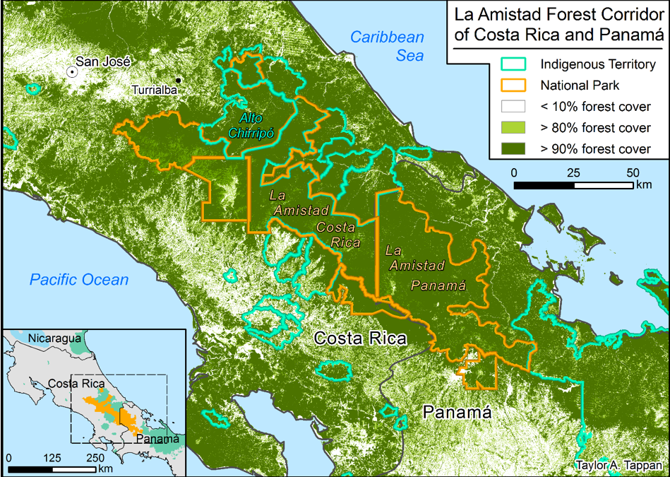
My dissertation research identifies the autonomous Cabécar territory Alto Chirripó (Figure 1)—the largest indigenous territory in Costa Rica and an integral component of Central America’s broader Mesoamerican Biological Corridor–as a test site for the following three overarching inquiries: (1) What is the long-term (40-year) signature of swidden-fallow agriculture on Alto Chirripó’s upland rainforest? (2) Which factors drive local farmers’ decision-making processes in creating and maintaining forest fallows? and (3) Are individual households accumulating land within Alto Chirripó, and if so, what social and environmental consequences play out through this process? I seek a holistic answer to these inquiries by integrating a multi-scale and multi-temporal approach that combines on-the-ground, community-based methods from participant observation (PO), participatory rural appraisal (PRA), and participatory research mapping (PRM) with in-the-sky interpretation of satellite imagery and aerial photography.

Figure 1: Alto Chirripó in the Amistad Forest Corridor (source: Hansen et al. 2013; Herlihy, Tappan, and Fahrenbruch 2018)
The 2018 CLAG Field Study Award supported the first two months of my dissertation research in which I began the quantitative, GIS and remote sensing-based component that involves land use/land cover (LULC) mapping from satellite imagery and aerial photography. To detect and quantify changes through time in LULC classes, one must access a time series of imagery and then interpret, compare, and digitize. This kind of intensive visual interpretation is better than computer-automated classification techniques for detecting nuanced LULC changes at the hectare or sub-hectare scale, where much of the swidden-fallow agriculture plays out in Alto Chirripó. While working from an office in Universidad Nacional, my host institution in Costa Rica, approximately 750km2 of my study area have been mapped at 1:10,000 scale for the year 2018.
Qualitative community-based participatory rural appraisal (PRA) and participatory research mapping (PRM) represent the counterweight to the quantitative GIS- and remote sensing-based approaches for this study. In November 2018, I will move to Grano de Oro—a small community along the western margin of Alto Chirripó—to begin nine months of in-situ field work. Community-drawn sketch maps, resource use questionnaires with associated toponyms, crop cycle calendars, and transects diagramming land use and land tenure are among the tools we will implement to address questions 2 and 3. All raw data and processed results of this study will be submitted to the Cabécar Indigenous Association as a contribution towards developing Alto Chirripó’s first ordenamiento territorial, or management plan for use and allocation of land and natural resources.

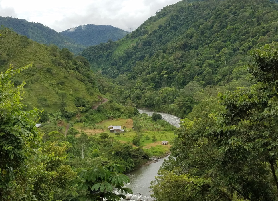
Community of Simiriñak along the banks of the Río Pacuare, Alto Chirripó Territory. Photo credit: Taylor Tappan.
I would like to extend a profound thank you to CLAG for the Field Study Award. Since my initial CLAG proposal submission, my adviser (Peter Herlihy) has helped me to improve my proposal, which was selected for a Fulbright-Hays DDRA Fellowship to continue funding my dissertation research in Costa Rica in 2019. I look forward to presenting results of this research at a future CLAG meeting
Please see the full report for more details.


