
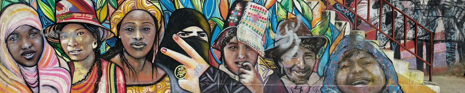

Mapping Flower Plantations in the Equatorial High Andes
Cut flowers have become the premier agricultural export of the high Andes over the last two and a half decades. The expansion of...
![]()
Conference of Latin American Geography
Cut flowers have become the premier agricultural export of the high Andes over the last two and a half decades. The expansion of...
This paper considers a specific mapping exercise undertaken by cartographers in the American Geographical Society during the 1930s as part of a larger...
By contrasting a National Geographic Society (NGS) map of the Panama Canal from 1912 with an earlier French map of the canal from...
Images, maps, and written texts together may constitute an imaginative geography and provide poignant evidence for how space can be socially constructed. In...
The article explores the environmental content of urban modernity in a nineteenth-century Latin American capital city through a comparative analysis of the cartographic...
This paper discusses four key geographical works published between the late 19th and early 20th centuries in the context of competing proposals about...
In 1764, Spanish colonel Luis Diez Navarro mapped the racially diverse British settlement at Black River on what is today the coast of...
Existing scholarship on Spanish America’s cartographic cultures largely overlooks mining maps. The Bourbon era, however, witnessed a proliferation in map production within the...
The origins of this special issue can be traced to conversations four years ago I had with then-JLAG editor, David Robinson. Those early...
2015 has been a year of change for JLAG. After 13 years of sure-handed guidance from David Robinson, I took over as editor...
10175 Christopher Gaffney (2010).
Mega-events and socio-spatial dynamics in Rio de Janeiro, 1919-2016
Journal of Latin American Geography 9(1).
http://muse.jhu.edu/article/377416
7214 Doribel Herrador Valencia; Enric Mendizábal Riera; Martí Boada i Juncà (2012).
Participatory Action Research Applied to the Management of Natural Areas: The Case Study of Cinquera in El Salvador
Journal of Latin American Geography 11(1).
http://muse.jhu.edu/article/470629
5709 Maria Elisa Christie (2002).
Naturaleza y sociedad desde la perspectiva de la cocina tradicional mexicana: género, adaptación y resistencia
Journal of Latin American Geography 1(1).
http://muse.jhu.edu/article/215263
4461 Karl H. Offen (2004).
The Territorial Turn: Making Black Territories in Pacific Colombia
Journal of Latin American Geography 2(1).
http://muse.jhu.edu/article/174024
3659 Jeremy Slack; Daniel E. Martínez; Alison Elizabeth Lee; Scott Whiteford (2016).
The Geography of Border Militarization: Violence, Death and Health in Mexico and the United States
Journal of Latin American Geography 15(1).
http://muse.jhu.edu/article/613266
3594 Jeffrey Todd Bury (2002).
Livelihoods, Mining and Peasant Protests in the Peruvian Andes
Journal of Latin American Geography 1(1).
http://muse.jhu.edu/article/215262
3191 Christian Brannstrom Adryane Gorayeb (2022).
Geographical Implications of Brazilâs Emerging Green Hydrogen Sector
Journal of Latin American Geography 21(1).
https://muse.jhu.edu/article/855961
2925 David J. Keeling (2005).
Latin American Development and the Globalization Imperative: New Directions, Familiar Crises
Journal of Latin American Geography 3(1).
http://muse.jhu.edu/article/177862
2778 James Freeman (2014).
Raising the Flag over Rio de Janeiro's Favelas: Citizenship and Social Control in the Olympic City
Journal of Latin American Geography 13(1).
http://muse.jhu.edu/article/539604
2696 Kathleen McAfee (2004).
Corn Culture and Dangerous DNA: Real and Imagined Consequences of Maize Transgene Flow in Oaxaca
Journal of Latin American Geography 2(1).
http://muse.jhu.edu/article/174022
312 Doribel Herrador Valencia; Enric Mendizábal Riera; Martí Boada i Juncà (2012).
Participatory Action Research Applied to the Management of Natural Areas: The Case Study of Cinquera in El Salvador
Journal of Latin American Geography 11(1).
http://muse.jhu.edu/article/470629
102 Matthew C. LaFevor (2012).
Sulphur Mining on Mexico’s Popocatépetl Volcano (1820–1920): Origins, Development, and Human-Environmental Challenges
Journal of Latin American Geography 11(1).
http://muse.jhu.edu/article/470631
90 Maria Elisa Christie (2002).
Naturaleza y sociedad desde la perspectiva de la cocina tradicional mexicana: género, adaptación y resistencia
Journal of Latin American Geography 1(1).
http://muse.jhu.edu/article/215263
89 Laura Sarmiento (2024).
Vida, conocimiento y territorio: Una geobiografía de Carlos Walter Porto-Gonçalves
Journal of Latin American Geography 23(1).
https://muse.jhu.edu/article/929691
84 (2024).
La política (a)científica del presidente de Argentina, Javier Milei
Journal of Latin American Geography 23(2).
https://muse.jhu.edu/article/939016
77 Karl H. Offen (2004).
The Territorial Turn: Making Black Territories in Pacific Colombia
Journal of Latin American Geography 2(1).
http://muse.jhu.edu/article/174024
77 Rogério Haesbaert (2024).
Carlos Walter Porto-Gonçalves, geografia como verbo: Paixão da terra que, pelos "de baixo", se faz território
Journal of Latin American Geography 23(1).
https://muse.jhu.edu/article/929690
67 Christian Brannstrom Adryane Gorayeb (2022).
Geographical Implications of Brazilâs Emerging Green Hydrogen Sector
Journal of Latin American Geography 21(1).
https://muse.jhu.edu/article/855961
66 Martha G. Bell; Jessica Budds; Gabriela Valdivia; Jörn Seemann; John C. Finn; Eugenio Arima (2023).
Contested Conference Locations: Perspectives on the 2024 AAG and CLAG Meetings
Journal of Latin American Geography 22(3).
https://muse.jhu.edu/article/915666
66 Penelope Anthias; Maria Cariola; Stine Krøijer; Mattias Borg Rasmussen (2024).
Leaks: The Politics of Awkward Circulations in Latin America's Geographies of Energy Production
Journal of Latin American Geography 23(3).
https://muse.jhu.edu/article/948095
1107 Doribel Herrador Valencia; Enric Mendizábal Riera; Martí Boada i Juncà (2012).
Participatory Action Research Applied to the Management of Natural Areas: The Case Study of Cinquera in El Salvador
Journal of Latin American Geography 11(1).
http://muse.jhu.edu/article/470629
688 (2024).
La política (a)científica del presidente de Argentina, Javier Milei
Journal of Latin American Geography 23(2).
https://muse.jhu.edu/article/939016
567 Rogério Haesbaert (2024).
Carlos Walter Porto-Gonçalves, geografia como verbo: Paixão da terra que, pelos "de baixo", se faz território
Journal of Latin American Geography 23(1).
https://muse.jhu.edu/article/929690
519 Maria Elisa Christie (2002).
Naturaleza y sociedad desde la perspectiva de la cocina tradicional mexicana: género, adaptación y resistencia
Journal of Latin American Geography 1(1).
http://muse.jhu.edu/article/215263
504 Penelope Anthias; Maria Cariola; Stine Krøijer; Mattias Borg Rasmussen (2024).
Leaks: The Politics of Awkward Circulations in Latin America's Geographies of Energy Production
Journal of Latin American Geography 23(3).
https://muse.jhu.edu/article/948095
449 Christian Brannstrom Adryane Gorayeb (2022).
Geographical Implications of Brazilâs Emerging Green Hydrogen Sector
Journal of Latin American Geography 21(1).
https://muse.jhu.edu/article/855961
423 Karl H. Offen (2004).
The Territorial Turn: Making Black Territories in Pacific Colombia
Journal of Latin American Geography 2(1).
http://muse.jhu.edu/article/174024
408 Martha G. Bell; Jessica Budds; Gabriela Valdivia; Jörn Seemann; John C. Finn; Eugenio Arima (2023).
Contested Conference Locations: Perspectives on the 2024 AAG and CLAG Meetings
Journal of Latin American Geography 22(3).
https://muse.jhu.edu/article/915666
405 Laura Sarmiento (2024).
Vida, conocimiento y territorio: Una geobiografía de Carlos Walter Porto-Gonçalves
Journal of Latin American Geography 23(1).
https://muse.jhu.edu/article/929691
360 Jessica Budds; Kathleen O'Reilly (2023).
Reforming Water Governance in Chile: A Hydrosocial Relations Perspective
Journal of Latin American Geography 22(3).
https://muse.jhu.edu/article/915672
5709 Maria Elisa Christie (2002).
Naturaleza y sociedad desde la perspectiva de la cocina tradicional mexicana: género, adaptación y resistencia
Journal of Latin American Geography 1(1).
http://muse.jhu.edu/article/215263
2344 Danilo Borja; Juan Bay; Conny Davidsen; Traducido por Yulia Garcia Sarduy (2021).
Ancianos amazónicos en la frontera petrolera: La vida y muerte de Nenkihui Bay, líder tradicional Waorani
Journal of Latin American Geography 20(1).
http://muse.jhu.edu/article/787933
2269 Diana Vela-Almeida; Sofia Zaragocin; Manuel Bayón; Iñigo Arrazola (2020).
Imaginando territorios plurales de vida: una lectura feminista de las resistencias en los movimientos socio-territoriales en el Ecuador
Journal of Latin American Geography 19(2).
http://muse.jhu.edu/article/749633
1992 Diego B. Leal; David S. Salisbury; Josué Faquín Fernández; Lizardo Cauper Pezo; Julio Silva (2015).
Ideas cambiantes sobre territorio, recursos y redes políticas en la Amazonía indígena: un estudio de caso sobre Perú
Journal of Latin American Geography 14(2).
http://muse.jhu.edu/article/586857
1961 Colectivo de Geografía Crítica del Ecuador (2017).
Geografiando para la resistencia
Journal of Latin American Geography 16(1).
http://muse.jhu.edu/article/653095
1660 Jerónimo Ríos Sierra (2020).
Una aproximación (geo)politológica a la crisis de la COVID-19 en América Latina
Journal of Latin American Geography 19(3).
http://muse.jhu.edu/article/760939
1626 Geobrujas-Comunidad de Geógrafas (2021).
Cuerpos, fronteras y resistencia: mujeres conjurando geografía a través de experiencias desde el otro lado del muro
Journal of Latin American Geography 20(2).
https://muse.jhu.edu/article/799599
1381 Christian Abizaid; Luis Ángel Collado Panduro; Sergio Gonzales Egusquiza (2020).
Pobreza Y Medios De Subsistencia En La Amazonía Peruana En Tiempos De La Covid-19
Journal of Latin American Geography 19(3).
http://muse.jhu.edu/article/760940
1319 Robert B. Kent (2012).
La geografía en América Latina: Visión por países
Journal of Latin American Geography 11(1).
http://muse.jhu.edu/article/470642
1256 (2024).
La política (a)científica del presidente de Argentina, Javier Milei
Journal of Latin American Geography 23(2).
https://muse.jhu.edu/article/939016
1779 Rogério Haesbaert (2024).
Carlos Walter Porto-Gonçalves, geografia como verbo: Paixão da terra que, pelos "de baixo", se faz território
Journal of Latin American Geography 23(1).
https://muse.jhu.edu/article/929690
1733 Rogério Haesbaert (2020).
Território(s) numa perspectiva latino-americana
Journal of Latin American Geography 19(1).
http://muse.jhu.edu/article/744032
1577 Luciene Cristina Risso; Clerisnaldo Rodrigues de Carvalho (2022).
A exibição de antipolíticas indígenas e ambientais orquestrada pelo governo brasileiro de Bolsonaro
Journal of Latin American Geography 21(2).
https://muse.jhu.edu/article/863335
1492 Joana Salém Vasconcelos (2021).
Cuba, protestos e caminhos da revolução
Journal of Latin American Geography 20(3).
https://muse.jhu.edu/article/835650
1231 Laura Sarmiento (2016).
JLAG Perspectives: Vida, Conhecimento e Território: uma geobiografia do Carlos Walter Porto-Gonçalves
Journal of Latin American Geography 15(3).
http://muse.jhu.edu/article/639102
768 Joseli Maria Silva; Marcio Jose Ornat (2020).
Geografias feministas na América Latina: desafios epistemológicos e a decolonialidade de saberes
Journal of Latin American Geography 19(1).
http://muse.jhu.edu/article/744044
765 Jessica Budds; Martha G. Bell; John C. Finn; Jörn Seemann; Eugenio Arima; Gabriela Valdivia (2023).
Language, Translation, and the Practice of Decolonizing Academic Publishing / Lengua, traducción y la práctica de la descolonización de las publicaciones académicas / Linguagem, tradução e a prática de descolonização das publicações acadêmicas
Journal of Latin American Geography 22(2).
https://muse.jhu.edu/article/909083
284 Christian Dennys Monteiro de Oliveira; Fabrício Américo Ribeiro; Ivo Luis Oliveira Silva; Luiz Raphael Teixeira Silva; José Arilson Xavier de Souza; Gerlaine Cristina Franco; Marcos da Silva Rocha; Maryvone Moura Gomes; Camila Benatti (2020).
As organizações religiosas brasileiras frente à pandemia de COVID-19
Journal of Latin American Geography 19(3).
http://muse.jhu.edu/article/760909
214 Vinicius Santos Almeida (2020).
Necromobilidade durante a pandemia da Covid-19
Journal of Latin American Geography 19(3).
http://muse.jhu.edu/article/760907
169 Antoinette M.G.A. WinklerPrins (2009).
Cidades da Floresta: Urbanização, Desenvolvimento, e Globalização na Amazônia Brasileira (review)
Journal of Latin American Geography 8(1).
http://muse.jhu.edu/article/260547